Author Margaret Dowland
Southrepps Commons are located in Lower Southrepps and consist of five separate Commons. The largest is Southrepps Common itself, which is a Site of Special Scientific Interest (SSSI). It is accessed either from Warren Road, the car park in Lower Street or from Bradfield Road.
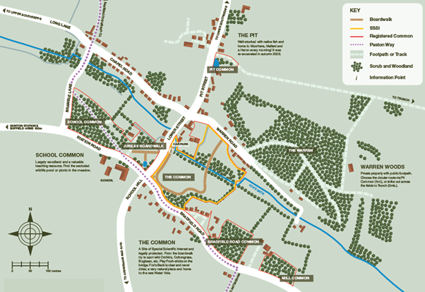
The other Commons are:
School Common opposite the school, Pit Common on Pit Street, Bradfield Road Common and Mill Common, both on Bradfield Road.
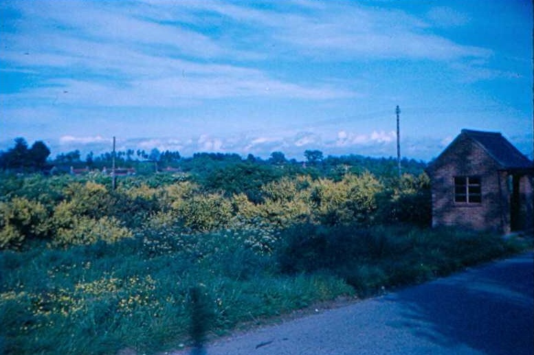
Each common has very different and distinctive habitats: sand pits, fen, woodland, wet carr, reed beds, ponds, swamp, and stream.
Table of Contents
- How long has it been Common land?
- Cutting the fen and reed beds
- Removing the cut material from the fen and reed beds.
- Pit Common
- School Common
- Bradfield Road Common
- Mill Common
- Gallery
How long has it been Common land?
It was decreed in the Duchy of Lancaster, in the 36th year of Henry VIII that the King’s tenants of his manors of Gymingham, Antingham, Thorp, Bradfield, Trunch, and South Repps adjoining to the common, should have their accustomed right in the commons between the said towns (North Erpingham Hundred: Thorp-Market, An Essay towards a Topographical History of the County of Norfolk: volume 8, pp. 171-175).
We can therefore say with confidence that the Commons have been recognised as such at least as far back as 1545.
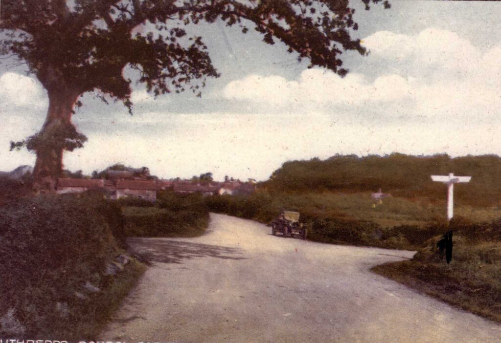
The Commons we have today are the last remnants of the vast Antingham and Walsham Common that extended between Thorpe Market and North Walsham as shown on BA Biederman’s 1784 map of the Gunton Estate and Faden’s 1797 map of Norfolk.
Across Southrepps Commons are some unusual earthworks and in 2019 Norfolk Wildlife Trust commissioned a report by Professor Tom Williamson of University of East Anglia. At first he thought they may be peat diggings, as records from the 13th century show peat digging in the area, but the professor concluded in his draft report that they were plausibly animal pens for the cattle market as recorded in White’s 1845 directory ‘A cattle the Tuesday fortnight after Whit Monday’.
There is also evidence of extensive sand digging on School, Bradfield Road, and Mill and Pit Commons.
For centuries the commons were grazed and rabbits from the nearby warren kept the vegetation particularly the trees in check. The arrival of Myxomatosis in the 1950s had a devastating affect on the rabbits. The need for grazing also declined, Trigger was the last known horse to be grazed here in the 1980s. As a result more aggressive vegetation began to take hold.
On School Common annual fires kept the growth in check. This stopped in 1953 when power cables were run across the common.

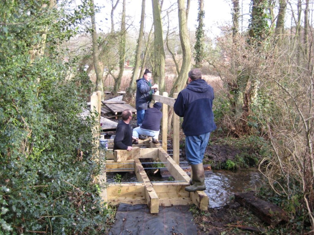
Norfolk County Council, with the agreement of the Gunton Estate, had been carrying out conservation work on the commons in the late 1980s. On the death in 1988 of Dame Cecilia Harbord, the last direct connection with the Gunton Estate, negotiations began to transfer ownership of the Southrepps Commons to the Parish Council. On the 9th March 1989 a public meeting was held to propose a management plan under the guidance of Norfolk County Council and Natural England. Approximately 60 Parishioners attended and the first committee was elected. The Chairman was Vic Purdy. Plans and funding were already in place to lay a boardwalk from Warren Road to the Social Club car park. In April 1990 YTS (Youth Training Scheme) trainees constructed a 100m section of boardwalk and built the bridge nearest the car park. The full length of boardwalk was completed in June 1990 by a combined group of YTS trainees and local volunteers. It was then that Southrepps Common received its SSSI designation in respect of its unusual combination of flora and insects. All the commons were also registered formally Common land. They also have designations of Local Nature Reserves and are all Open Access land.
As the need for greater organisation increased and to enable the group to access funding the Southrepps Commons Trust (SCT) was formed in 2005. It was registered as a charity. Vic Purdy served as chairman until 2009.
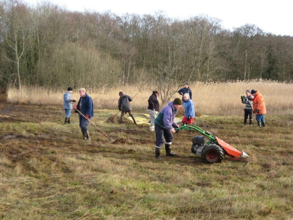
John Daniels was elected Life President to reflect the work he had done in saving the Commons. David Spencer became chairman in 2009 followed by John Houlgate in 2011. John had been secretary until this time and remained chairman until 2019. The volunteers held regular working parties to fulfil the requirements of the plan laid down by Natural England.
Cutting the fen and reed beds
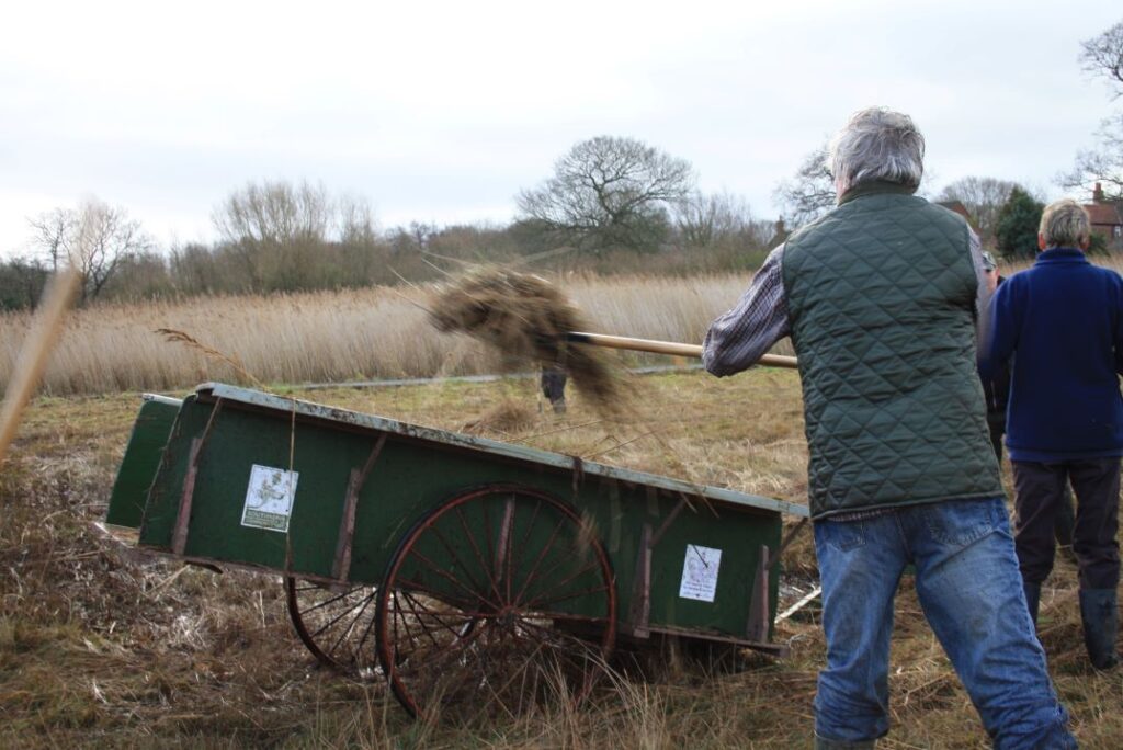
The fen and reed beds were cut and the material removed in order to prevent the ground from becoming enriched by the decomposing matter which would then inhibit the growth of the fen plants that thrive on poor soil. It also controlled the growth of tree saplings, which would otherwise turn the area into a wood.
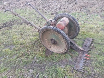
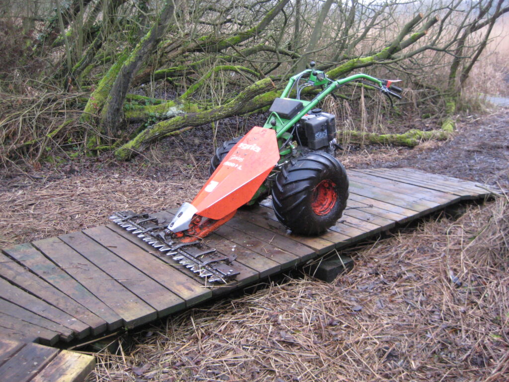
When the Commons were first acquired by the parish, they were cut by council contractors or with a very old Oxford Allen scythe owned by John Daniels. This was very dangerous as there was no way of disengaging the blades when the machine was running.
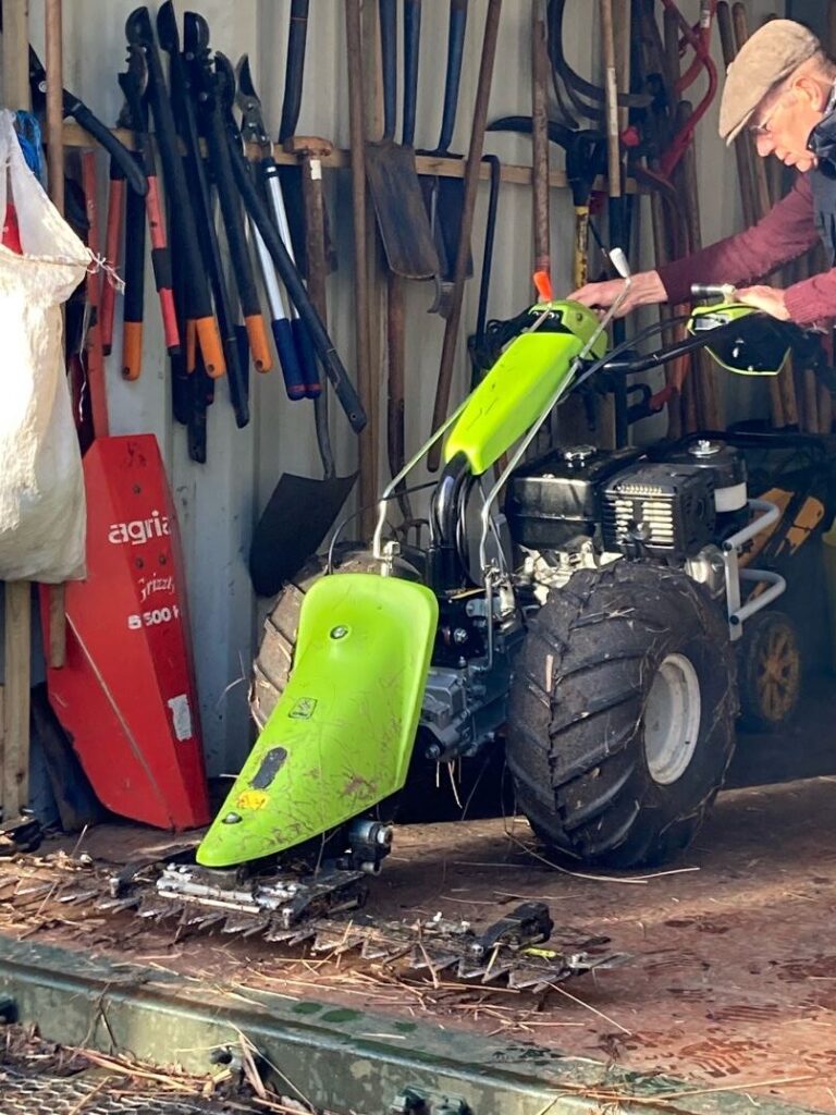
When the SCT was formed the first action was to buy with the assistance of English Nature, an oscillating scythe known as Grizzly. This was powered by diesel and heavy to use.
Removing the cut material from the fen and reed beds.
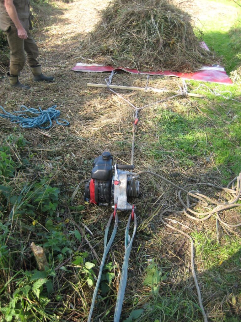
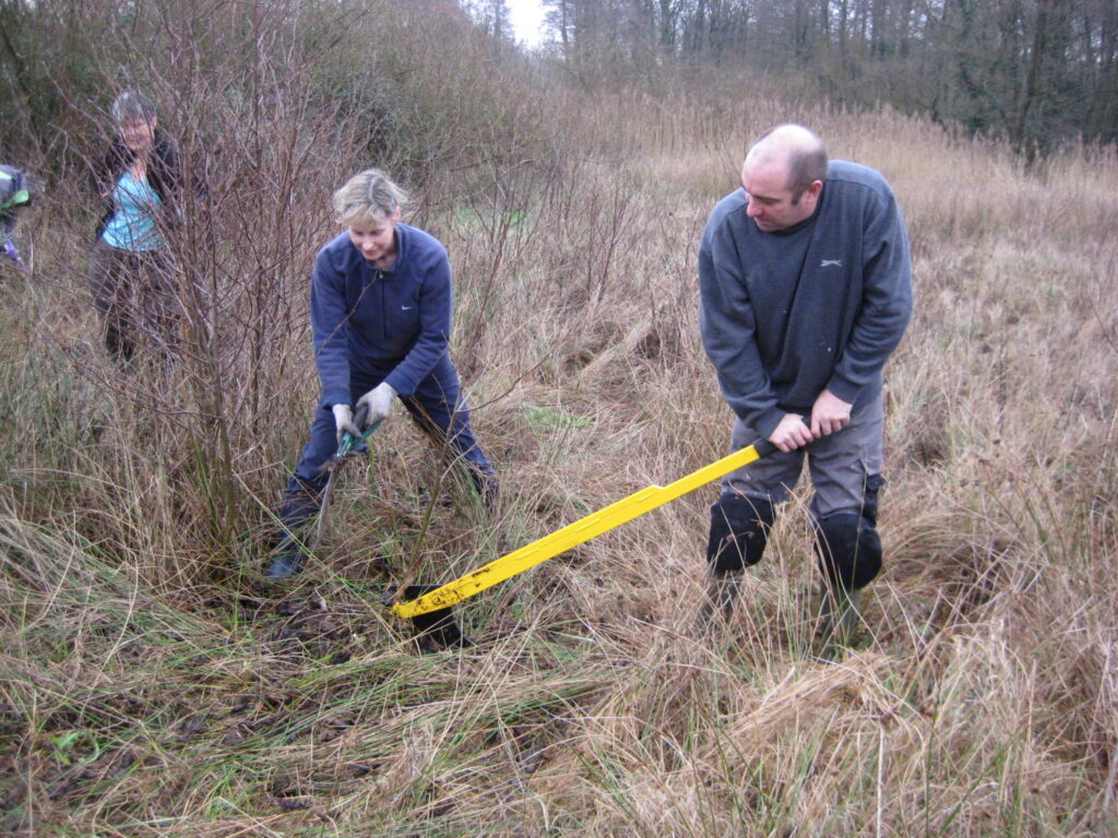
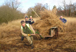
Removing the cut material from the site is hard work and from the start this was done by hand, with volunteers forking up the arisings onto sheets made from the curtain sides of lorries. These would then be hauled by a group of people to dumping sites at the side.
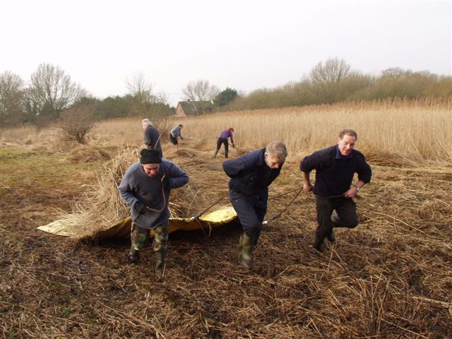
Three volunteers pulling one of the original yellow sheets. These were then turned over by hand at the dump site. The skill was not to load them too high as most of the material was wet and very heavy. John Houlgate Chairman of the Trust decided that there had to be an easier way of moving the cut material.
(Dowland)
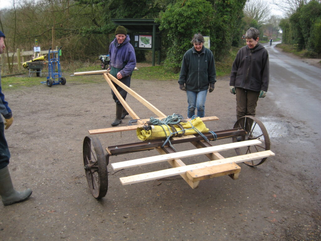
This resulted in the cart mark 1. This one was not up to the job so the drawing board was returned too. Cart mark 2 was double ended which allowed the cut material was pushed through the cart. it could be pulled to the dumpsite.
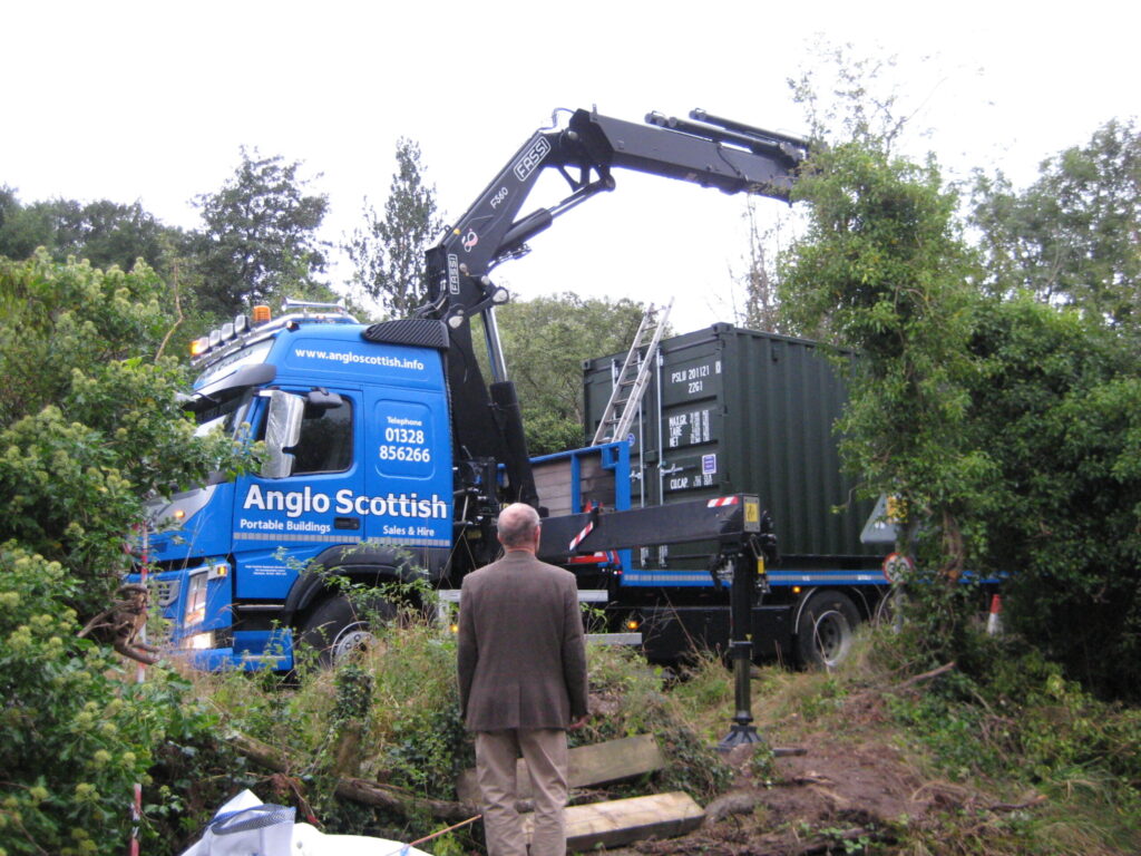
The next innovation was the purchase of a winch which meant new pull sheets that could take larger loads. The winch could also help unload at the dump site. With so much equipment a storage container was bought and installed in 2016.

Southrepps Commons Trust’s proudest moment came when it was presented with the Queens Award for Voluntary Service in 2011.
The Crystal trophy and certificate are on display in the village hall.
Over the next few years it became harder to recruit new volunteers and the age of the remaining ones increased. This combined with the loss of the grant from Natural England meant that the probability of the Parish being faced with the expense of maintaining the commons using contract labour was very high. So in 2019 all the Commons were transferred to The Norfolk Wildlife Trust in order to guarantee their future. The Trust was dissolved and the volunteers became the Southrepps Commons Volunteers and they continue to maintain the Commons, under the guidance of NWT. You can read their blog.
Pit Common
Pit Common was formed by sand extraction and underneath all the scrub is a quarry wall which had at one time Sand Martins nesting in it. The Pit has no natural spring and fills from road run off and rain fall. It can dry up completely in the summer. In the past it was used to water livestock on the way to market. In 2020 under the care of NWT part of the grass area was spread with wild flower seed to increase the biodiversity. The pond itself is an important breeding site for the common toad.
School Common
This is the area opposite the school and a boardwalk crosses part of it was installed in 2002. There are extensive sand pits, particularly in the SW corner where there is a drop of some 20 feet from the roadway.
On the southern edge can be found some wartime zig-zag trenches that were dug for training purposes. At the time there would have been no trees at all.
Bradfield Road Common
Much of it is bracken and woodland, where the oldest trees on Southrepps Commons are found.
Mill Common
It takes its name from the post mill that was once in use here. It is now mainly woodland but is shown on old maps as a sand pit. There is evidence of a former pond, which has dried out, probably due to lowering of the
water table.
Gallery
Click or touch on a picture to see an enlarged version of it, from which you can browse to others by clicking on the right or left arrows, or by swiping on your phone or tablet, With an enlarged image displayed, the i inside a circle in the bottom right corner will provide more information about the photograph, including, where present, the names of people in the picture. The square icon will display any published comments made about the picture, and here you can also send us your own comments.